Part – 1
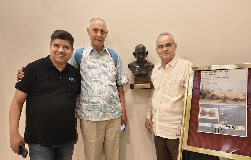
I had read about the Schlagintweit brothers before, but learning that their drawings would be exhibited in India for the first time—through a collaboration between PAHAR and German scholars—felt truly special. I found myself eagerly looking forward to the exhibition at the India International Centre. Even before it opened, I was assigned the task of preparing the exhibition catalogue for the web. It wasn’t easy—the catalogue ran over 70 pages—but as I worked through it, something shifted. Each page revealed new layers of history, exploration, and human connection, drawing me deeper into the world of the Himalayas. A day before the exhibition, I arrived at the venue as a PAHAR volunteer and had the chance to meet Shekhar da (Prof. Shekhar Pathak) and Professor Hermann Kreutzmann—two remarkable minds from different parts of the world, united by their deep engagement with the Himalayas. Knowing they would be speaking soon only heightened my anticipation. When the lecture finally took place, it more than lived up to its expectations.
On a 22nd April afternoon in New Delhi, inside a quiet lecture room at the Annexe of the India International Centre, time seemed to bend.
The event—part of the exhibition “Himalayan Encounters: Hidden Views from 170 Years Ago”—was not just a scholarly gathering. It was a journey. A journey that began in 18th-century Europe, crossed icy Himalayan passes, and returned to us through fragile sketches, forgotten voices, and enduring questions about how knowledge is made.
Let’s explore the first lecture. Professor Hermann Kreutzmann, a scholar from the Free University of Berlin, provided a detailed look at the 19th-century German scientific mission to the Himalayas, situating the Schlagintweit brothers’ work within a deep web of intellectual and international connections.
His session highlighted several fascinating links between philosophy, global exploration, and local collaboration: At the center of this journey stood an unlikely figure: Immanuel Kant.
A Philosopher Who Never Traveled—Yet Saw the Himalayas
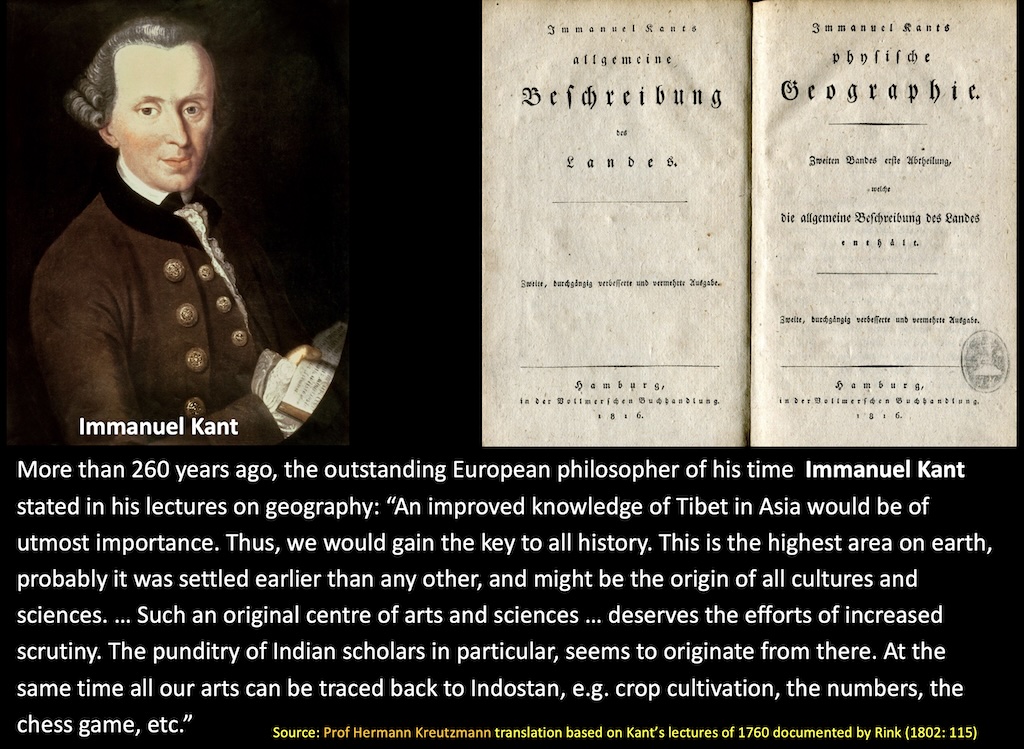
Kant never left his hometown of Königsberg. Not once. And yet, more than 260 years ago, he was already imagining the Himalayas as the “key to all history.”
In his lectures on geography, he proposed something astonishing: that Tibet and the greater Himalayan region might be the cradle of human knowledge—where sciences, arts, and even systems like numbers and chess may have originated before spreading outward.
Today, that idea feels speculative, even romantic. But in Kant’s time, it ignited curiosity. It planted a seed in the European imagination: that somewhere in the towering mountains of Asia lay answers to humanity’s oldest questions.
That seed would eventually grow into an expedition.
The Man Who Sent Others in His Place
Fast forward to the 19th century. Enter Alexander von Humboldt—a towering figure in science, often called one of the founders of modern geography and environmental thinking.
Humboldt was obsessed with mountains. He believed that by studying mountain systems across the world, one could understand the Earth itself—its structure, climate, and life systems.
But there was a problem.
By the time the opportunity arose to explore the Himalayas, Humboldt was nearly 80. Too old to go.
So he did what great minds sometimes do—he delegated the adventure.
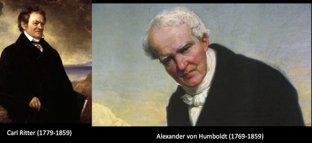
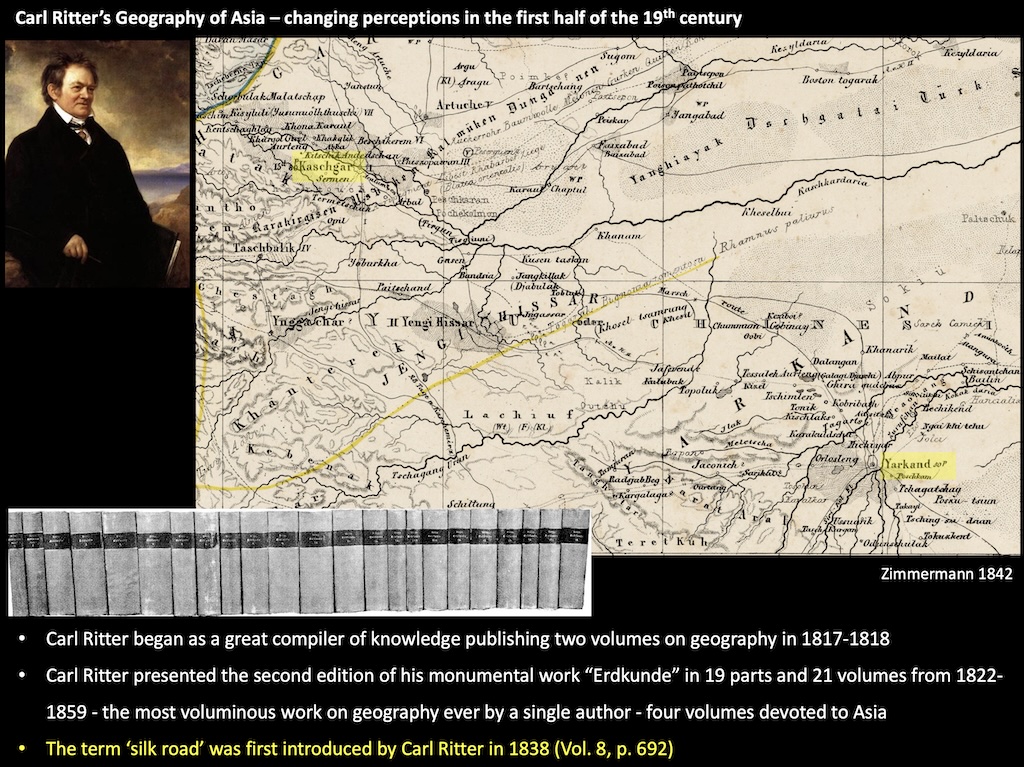
There is another towering personality, Carl Ritter and his partnership with Humboldt that quietly shaped it all.
They were the founders of what came to be known as the Berlin School of Geography.
Ritter, who became the first Professor of Geography in Berlin in 1820, and Humboldt, already celebrated for his expeditions to Latin America and Siberia, were united by a shared vision: that geography must be built on empirical observation and a global exchange of knowledge.
Together, they helped establish the Berlin Geographical Society in 1828, nurturing a generation of explorers driven to fill in the “blank spaces” on the world map—India and the Himalayas among them.
Fittingly, both Humboldt and Ritter passed away in 1859—the very year the Schlagintweits’ work began to reach the wider world—closing one chapter even as another was just beginning.
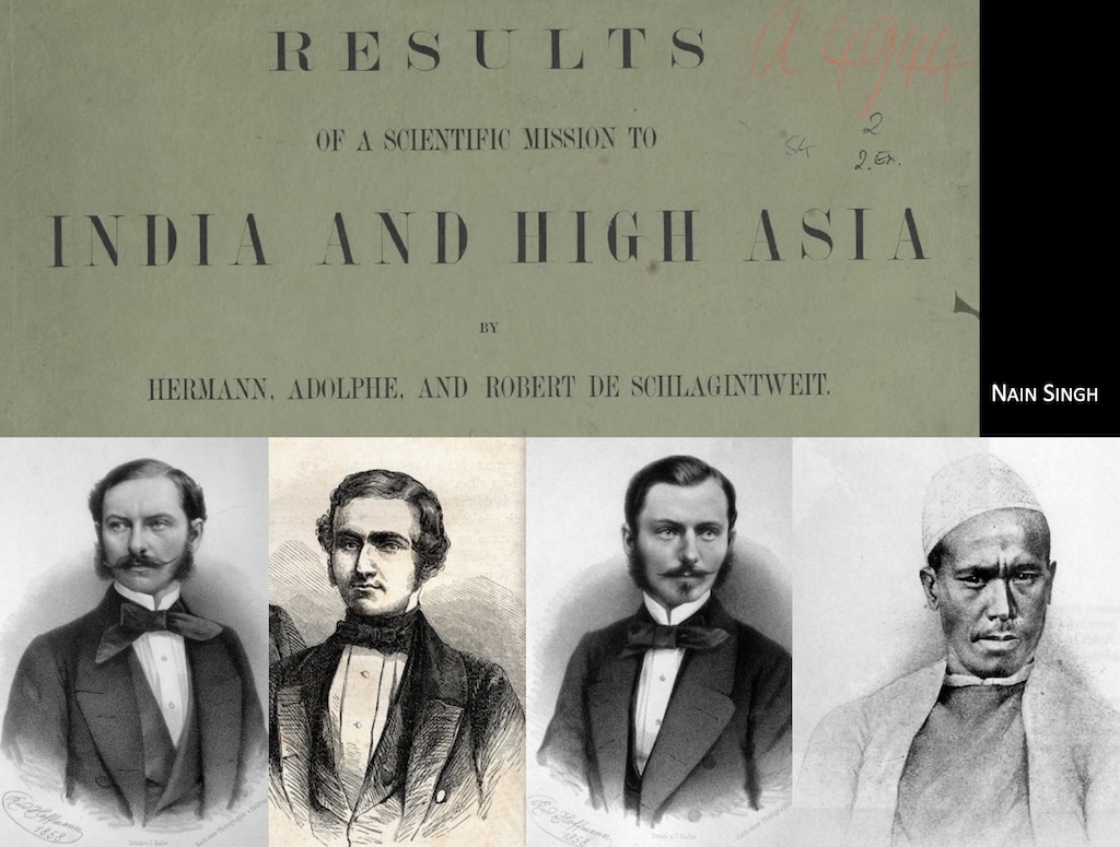
The Schlagintweit Brothers: Science Under a Pretext
Humboldt used his influence with the British establishment to send three German brothers—Adolf, Hermann, and Robert Schlagintweit—to India.
Officially, they were hired by the East India Company for a magnetic survey—a scientific mission to locate mineral resources.
Unofficially? It was a gateway.
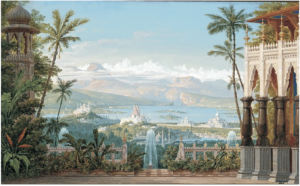
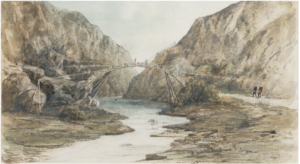
Between 1854 and 1858, the Schlagintweits traveled across the Himalayas, documenting landscapes, cultures, and scientific observations with remarkable detail. They produced over 750 sketches and paintings—77 of which now form part of the current exhibition in Delhi.
Ironically, the “magnetic survey” yielded little of economic value. But what it unlocked instead was far more enduring: a visual and intellectual archive of a region still largely unknown to European science.
The “Silk Road” Was Named Before It Was Famous
During the session, another surprising detail emerged.
The term “Silk Road”—so widely used today—was actually coined in 1833 by Carl Ritter.
This reminds us that geography is not just about discovering places—it’s also about naming and framing them. The way we describe the world shapes how we understand it.
A Global Race for a Single Place

The 19th century was an age of exploration—but not in isolation. It was deeply interconnected.
Take the quest to locate Yarkand, a key city in Central Asia.
Explorers approached it from multiple directions:
- The Schlagintweits from the south
- Russian geographers from the north
- Others from the Chinese side
It was a “cosmopolitan affair,” as Professor Hermann Kreutzmann described—a mix of competition and collaboration.
Even more telling: decades after Adolf Schlagintweit was killed near Kashgar, Russian officials erected a monument in his honor. Science, it seems, often transcended national rivalries.
The Invisible Backbone: Local Knowledge
But perhaps the most powerful part of the story lies not in Europe—but in India and the Himalayas themselves.
The Schlagintweits did not work alone. Their expedition depended on a vast “establishment”—over 100 local assistants, guides, and experts.
Among them were figures like Nain Singh Rawat, Mani Singh, and Harkishan.
The brothers didn’t speak local languages. They had no prior experience with high-altitude terrain.
Their diaries, therefore, are not purely their own voices. They are layered records—translations, interpretations, and lived knowledge shared by local experts.
This flips the narrative.
What we often call “European exploration” was, in reality, deeply collaborative. Knowledge flowed both ways. Skills were exchanged. Survival depended on trust.
Then and Now: A Landscape Transformed
One of the most striking aspects of the exhibition is its ability to collapse time.
A painting from 1855 shows Nainital as a small, quiet settlement—almost unrecognizable compared to today’s bustling hill town.
For scientists today, these artworks are not just aesthetic objects. They are data.
Glaciologists, geographers, and environmental historians use them to compare past and present landscapes—tracking how glaciers have receded, forests have changed, and human settlements have expanded over 170 years.
Art becomes evidence.
The Long Journey of the Drawings
The story doesn’t end in the 19th century.
- 1859: The brothers publish a catalogue of their panoramic views
- 1997: Their drawings are donated to the Alpine Museum in Munich
- 2015: A major exhibition is held in Munich
- 2026: After years of effort—especially by historian Shekhar Pathak—the drawings finally come to India
This exhibition is, in a way, a homecoming.
A return of images that captured Indian landscapes—now seen again on Indian soil.
What Do We Take Away?
Sitting in that lecture room in Delhi, one realization becomes clear:
This is not just a story about explorers or mountains.
It’s about how knowledge is built.
- A philosopher imagines a distant land he never sees
- A scientist sends others to explore it
- Local experts make the journey possible
- Artists record what science cannot fully explain
- And centuries later, we reinterpret it all
The Himalayas, in this story, are not just a place.
They are a meeting point—of ideas, cultures, ambitions, and perspectives.
And perhaps Kant was right about one thing, even if not in the way he imagined:
To understand the Himalayas is not just to understand a region.
It is to glimpse the vast, interconnected story of human curiosity itself.
Part -2: Pundit of Pundits: The Man Who Measured the Himalayas—Step by Step
Part -3: The Closing That Opened New Worlds

Shahbash!